|
The very best choice for safe navigation and effective
fishing!
| Features |
|
|
| ・ |
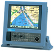
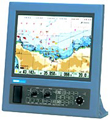
C-Map NT MAX compatible |
|
| ・ |
High brightness wide-view angle LCD for steady, crisp, flicker-free
image |
|
| ・ |
Various marks and greater numbers of ship's track |
|
| ・ |
All stored memory securely protected with double layer memory |
|
| ・ |
Operation "easy" design with logically arranged
keypads and controls |
|
|
|
| Main Specifications |
|
|
| GTD-110/150 Chart Plotter |
| Track zooming range |
0.01 to 3,600 nm (or 0.02 to 6,600 km) |
| Plotting interval time |
1, 2, 5, 10, 20, 30, 60, 120, 300, 600 sec |
| Plotting interval distance |
0.01, 0.02, 0.05, 0.1, 0.2, 0.5, 1.0, 2.0, 5.0, 10.0 nm (km) |
| Number of plots |
2,000, 4,000, 7,000 (maximum plot) x 7 blocks |
| Track color |
7 colors |
| Route memory |
50 routes x 50 waypoints |
| Chart |
C-Map NT / NT+ / NT MAX |
| Data card |
C-Map User C-Card |
|
|
|
|
|
|
|
|
|
 |
|
|
|
|